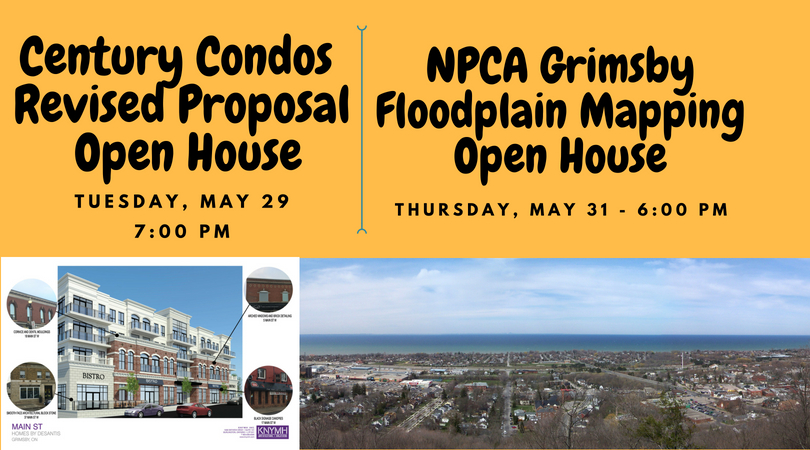
REMINDER: Century Condos Open House – May 29 @ 7 pm – Town Hall
Don’t miss the May 29th Public Open House at 7:00 pm on the Century Condos downtown development to hear about the revised 4 storey proposal and provide any comments you may have.
There is a marked improvement in the “heritage look and feel” of the revised façade and we’re happy to see that the maximum of four storeys in the Official Plan is respected. Read our previous posts by clicking here.
The Planning & Development Committee meeting agenda follows:
https://grimsby.civicweb.net/filepro/documents?expanded=542,773,89907&preview=94513
NPCA Floodplain Mapping Public Open House – May 31, 6-8 pm – Town Hall
If your property is within 300 metres of these watercourses, you should attend this meeting as your property may be impacted – outlets 1, 2, 9, 22, 25 and 30 (Forty Mile Creek subwatershed). The location of these outlets (watercourses) are shown on the maps on the website.
Floodplain mapping is part of the requirement of the Grimsby GO Train Station Secondary Plan which was recently approved by Regional Council and is now in effect. Some of the watercourses impacted are within the Hunter Road (woodlot)/Casablanca Rd area.
Floodplain mapping also helps determine where development should be permitted
The NPCA Request for Proposal for the Floodplain mapping states the background and purpose as:
“The objective of the Niagara Peninsula Conservation Authority (NPCA) is to “establish and undertake, in the area over which it has jurisdiction, programs designed to further the conservation, restoration, development and management of its natural resources”. In order to fulfill this mandate, one of the responsibilities of the NPCA is to advocate and implement programs that contribute to keeping the public safe from flooding, erosion, and other natural hazards.
In 1989 floodplain mapping was generated for Prudhomme’s Creek, Bartlett Creek, and Beamsville/Konkle Creek in the Town of Lincoln, and for portions of Lake Ontario Tributaries #31, 32, 44, and 44a in the Town of Grimsby (as indicated on the attached ‘Current Floodplain Mapping’ sketch). In the ensuing 28 years, the Towns of Grimsby and Lincoln have experienced significant growth. In addition to updating this existing floodplain mapping, the NPCA is interested in generating new floodplain mapping on two additional watercourses: Lake Ontario Tributaries #29 and #39 in the Town of Grimsby.
As such, the Niagara Peninsula Conservation Authority (NPCA) is proposing to update and create new floodplain mapping for these watercourses utilizing the most up-to-date digital mapping, modelling techniques, and climatic data sets.”
Further clarification from the NPCA was received to identify those streets within proximity to the outlets (below – actual street addresses to be refined, not all homes are impacted). As well, updates to provide more details may be posted on the NPCA website as they become available.
https://npca.ca/events/grimsby-floodplain-mapping
Street Name Grimsby Outlet NPCA Tributary
Admiral Crt Grimsby Outlet 22 Lake Ontario 32
Arrowhead Lane Grimsby Outlet 30 Lake Ontario 29
Bartlett Ave Grimsby Outlet 30 Lake Ontario 29
Baseline Rd Grimsby Outlet 1 Lake Ontario 44A
Bendamere Dr Grimsby Outlet 30 Lake Ontario 29
Beverly St Grimsby Outlet 22 Lake Ontario 32
Blue Forest Dr Grimsby Outlet 30 Lake Ontario 29
Book Rd Grimsby Outlet 30 Lake Ontario 29
Cemetery Rd Grimsby Outlet 22 Lake Ontario 32
Central Ave Grimsby Outlet 25 Lake Ontario 31
Clark St Grimsby Outlet 22 Lake Ontario 32
Concord Pl Grimsby Outlet 9 Lake Ontario 39
Elmer Rd Grimsby Outlet 9 Lake Ontario 39
Hunter Road Grimsby Outlet 9 Lake Ontario 39
Industrial Dr Grimsby Outlet 9 Lake Ontario 39
Jeanette Ave Grimsby Outlet 22 Lake Ontario 32
Joseph St. Grimsby Outlet 2 Lake Ontario 44
Kelson Ave N. Grimsby Outlet 2 Lake Ontario 44
Lake Street Grimsby Outlet 25 Lake Ontario 31
Lawrence Ave Grimsby Outlet 30 Lake Ontario 29
Lillian Crt Grimsby Outlet 22 Lake Ontario 32
Lynnwood Ave Grimsby Outlet 25 Lake Ontario 31
Margaret Ave Grimsby Outlet 22 Lake Ontario 32
Morrison Cres Grimsby Outlet 22 Lake Ontario 32
Palmer Rd Grimsby Outlet 22 Lake Ontario 32
Plum Tree Lane Grimsby Outlet 25 Lake Ontario 31
Private Rd Grimsby Outlet 1 Lake Ontario 44A
Sandra Cres Grimsby Outlet 25 Lake Ontario 31
Sidare Crt Grimsby Outlet 2 Lake Ontario 44
Sumner Cres Grimsby Outlet 25 Lake Ontario 31
Terrace Ave Grimsby Outlet 30 Lake Ontario 29
Thomahawk Dr Grimsby Outlet 30 Lake Ontario 29
Tupper Blvd Grimsby Outlet 30 Lake Ontario 29
Winston Rd Grimsby Outlet 2 Lake Ontario 44
Windward Dr Grimsby Outlet 9 Lake Ontario 39
Council Notes – May 22
Official minutes: https://grimsby.civicweb.net/filepro/documents?expanded=1127,1965,90198&preview=94442
10 Windward Drive – Rosebay “Odyssey” (Old Planet Nite Club)
Franz Kloibhofer, Planner, A.J. Clarke and Associates Ltd., once again presented to Council on behalf of the developer. He stated that, after much discussion with Town planning staff, they confirmed the net lot size at 9,141.70 m2, the total gross floor area at 22,075 m2, and the gross floor index at 2.41 (2.5 is the max).
When asked why the building “has shrunk” and now appears to be 827 m2 less than the site plan stated (22,902 m2) at the April 16 Council meeting (and April 10 P&D), the response from the Town’s planner was:
“They originally included portions of the building that shouldn’t have been included…”
Read more in our previous posts on this development by clicking here.
Other discussion at Council included:
- Bill 139 – changes to the OMB and new LPAT – not much hope that it will give the public or Council more weight.
- Bill C45-C46 – Cannabis legislation – AMO is working with the Province to produce guidelines for municipalities.
- Phelps “Legacy” – 221, 229, 265 Central Avenue – updated conditions of approval provided.
- Mayor Bentley asked both developers (Phelps and Rosebay) to consider donating a unit to Habitat for Humanity.
- West End Fire Hall – bylaw passed to permit the Town Manager and Fire Chief to seek properties in the West End (Casablanca to Fifty Road/Main St W to the lake) for building a new fire station. There are two options, find a short-term location and just build one or two bays for now (maybe in partnership with a developer), then look for a longer term location for a full station. Mayor Bentley suggested that it could be contingent on the next Greenbelt review (8 years from now) and wants an opportunity to have options.
- Operations Centre will be over budget – tender awarded for $1,850,000 plus HST, original budget estimate $1,480,000 plus HST. Alderman Mullins asked that Council be kept apprised with interim reports.
- Site fill bylaw – regulated height of berms, confirmation that the soil dumped is what they say it is, damage to town roads caused by dump trucks. Mayor Bentley noted that we can’t charge anyone for damage to Town roads.
That’s all for this post!
Leave a Reply